CAPPADOCIA
Where
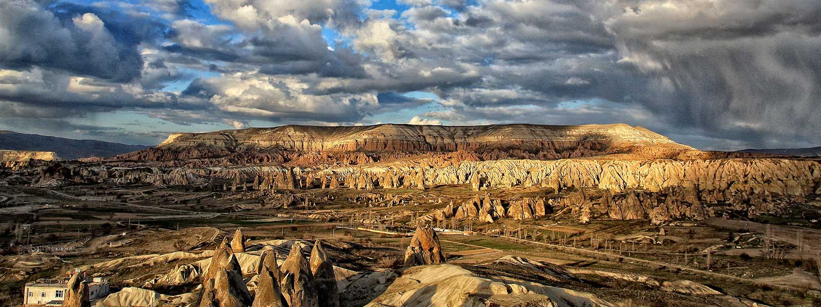
Cappadocia, ancient district in Central Anatolia, situated on the rugged plateau north of Taurus Mountains is in the center of present-day Turkey. It is home to one of the most spectacular landscapes in the world – deep valleys and soaring rock formations dotted with homes, chapels, tombs, temples and entire subterranean cities harmoniously carved into the natural landforms. Cities, empires, and religions have risen and fallen around these unique underground cities, yet they remain occupied to this day. Through the ages, the Hittites, Persians, Alexander the Great, Rome, The Byzantine Empire, Seljuk, Ottoman Empire, and Turkey have all governed this spectacular region of Central Anatolia.
History
Cappadocia was neighbored to the Commagene to the southeast, Armenia to the east, Galatia to the northwest, Pontus to the north, Cilicia to the south, and Phrygia and Lycaonia to the west. According to the worldly known geographer Strabo, who was born in Anatolia and lived about 63 BC, it measured 1800 stadia (332 kilometers) north to south, from Pontus to the Taurus mountains, and 3000 stadia (552 kilometers) west to east from Lycaonia and Phrygia to the Euphrates. In other words, the region was demarcated geographically by the Black Sea to the north, the Taurus Mountains to the south, the Kizilirmak River (Halys) to the west and the Euphrates to the east. The Tatta (Tuz Golu, Salt Lake) to the southwest marked the border between Phrygia and Lycaonia.
Name/Meaning
Some say that it has derived from the word Katpatuka which was first encountered in the list of the countries who paid tribute to the Persians during the reign of Darius l (522-486 BC) and is said to have meant the Land of Beautiful Horses. The elder Pliny, however in his natural history shows that the river Cappadox (Delice), a tributary of the Halys (Kizilirmak), as the origin of the name. Being aware of the fact that Kapadokya has never been a center for famous horses which could lead to name the region (which was a made-up story) as “the land of beautiful horses”, the probability that “Katpatuka” stands for a tributary of Red River seems closer to the reality. The Roman Historian Strabo named the area as more of a foresty land -even noting that monkeys would jump in between trees without touching the ground for a long distance. Another better source for the same would be "the city of King Teshub" recorded in earlier history.
As it is clear from the above discussion regarding the historical roots of its name, Kapadokya has an enduring history dating back thousands of years. Neolithic pottery and tools found in Asiklihoyuk, where signs of early brain surgery are found, attest to an early human presence in the region which dates back to 9th millennium BC. Excavations at the modern town of Kultepe have uncovered the remains of the Hittite-Assyrian city of Kanesh, dating from the 3rd millennium BC. The tens of thousands of clay tablets recovered from the remains of an Assyrian merchant colony at Kanesh are among the oldest written documents ever discovered in Turkey. The history of Cappadocia began in prehistoric times. Hatti culture (2500 - 2000 BC) had its way during the Bronze Age and in about the 2nd Millennium BC Assyrians, Hittites, Phrygians, Lydians and Persians all respectively left their marks on the region until the region became a Roman province in 17 AD. Once Asia Minor came under Christian influence, the first Christian communities appeared in Kapadokya and those persecuted for their religious beliefs elsewhere sought refuge in the region. Kapadokya thus became a melting pot of a variety of ethnic groups, all of which have influenced the culture and religious beliefs.
Geography
Geographically, the origins of this unusual region can be traced to the Tertiary period some 50 million years ago, when craters and chimneys dominated the landscape. Since then huge quantities of volcanic material have spewed out of the many volcanoes. Forces of erosion have shaped the incredible and unique tufa-coned landscape. The rock formations that make up this fairyland were created by volcanic eruptions, erosion, and the wind. Over three million years ago a volcanic eruption deposited a blanket of ash across the 1500 square mile landscape which formed into the soft rock. This rock, slowly eaten away by wind and time, has created some spectacular forms. For hundreds of years, men have dug into the soft but firm tufa to create dwellings, monasteries, churches and underground settlements. Goreme National Park, Pasabag, Devrent Valley and Uchisar Castle are the most important Highlights of Cappadocia where one can truly observe the unique landscape which continues to amaze its visitors especially with a bird-eye view from a hot-air balloon.


