ADIYAMAN
Adiyaman used to be known as Hisn-i Mansur until the republican era. It hosted many civilizations throughout its history including the Hittites, Mittanis, Urartians, Assyrians, Meds, Persians, Alexander the Great and the Kommagene. Adıyaman lived the periods of the Seljuk Turks, Crusades and Mamelukes in the 11th and those of the Anatolian Seljuks, Ilkhanite, and Mamelukes in the 12th century. It was annexed by the Ottoman Empire in 1516 during the reign of Yavuz Sultan Selim. The area has ample pieces, structures and specimens coming from the Hellenistic era, Romans and the Byzantine together with those belonging to the Islamic-Turkish heritage. These assets obtained during the salvation work started in 1978 along with the Lower Euphrates Project are now placed in Adiyaman Museum. The museum exhibits pieces obtained from excavations carried out at various tombs together with coins from the Roman and Seljuk times.
Historical sites within the central town include the Fortress, Carsi Mosque, Old Palace Mosque, Kap Mosque and the Grand Mosque. The Nemrut Mountain National Park Tumulus, Karakus Hill, Cendere Bridge, Old Fortress, New Fortress, the city of Perre, rock graves and Sesank are other sites in the province worth seeing.
The fortress of Adiyaman is placed on a man-made hill at the center of the town, built by the Omayyad Commander Munsur İbn-i Cavene to defend the city against the Byzantine attacks. Now remaining in a destroyed standing, the fortress has three main gates.
The territory of the province of the city extends from the slopes of the Southeastern Taurus Range to the Euphrates over an area of 7.614 square kilometers. It has a population of 678.999 according to the 1997 Census. Its administrative districts are the central city, Kahta, Golbasi, Besni, Celikhan, Gerger, Samsat, Sincik and Tut. The Euphrates, the most fertile river of Turkey forms the southern and eastern borders of the province.
The province mainly subsists on crop farming and stock breeding. Land under cultivation constitutes one-fourth of the total territory of the province. Main crops are wheat, barley, and corn. Vineyards which used to be an important source of income have been replaced by pistachio orchards.
Upon the completion of GAP, fish culture, cotton textile plants and facilities processing feed, milk and meat will gain weight in the province.


Cendere Bridge
This 2000 years old bridge is located on a stream 18 kilometers north of Kahta. It was built by XVI Leon who ruled the area during the time of Septimus Severus, the Roman Emperor. It is known that the bridge originally had four columns, dedicated to Septimius Severus, his wife Julia Domma, and their sons Caracalla and Getta. The one dedicated to Getta is believed to be removed after he was killed by his brother Caracalla.
Nemrut Mountain
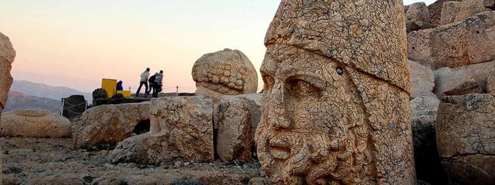
This 2.150 meters high mountain is known as the point where one can watch the most beautiful sunrise and sunset scenery. On the peak of the mountain which overlooks the Euphrates passages and plains there is a tumulus-tomb dating back to the Kommagene King I. Antiochos, an altar, sculptures of Zeus, Fortuna and Apollo as well as lion sculptures and eagle heads. These giant sculptures are in oriental style, massive and still. Eastern and western terraces have Greco-Persian style sculptures and reliefs. The King, considering himself in the same status as gods, is shown while shaking hands with the Persian gods. The Mountain was declared as national park in December 1988 in order to better protect the historical assets it is endowed with.
Karakus Hill
It is actually a 21 meters high tumulus, made up of calcareous materials and gravel, located by a brook (Nymphaios) 49 kilometers to the north of Adiyaman city center. To the south and west of the tomb, there are 9 meters high Doric style columns. On the top of each column, there are sculptures of bull, lion, and eagle and also a relief. The inscription on the eastern column reads that some close relatives of Mithridates, the King of Kommagene, are buried in the tumulus.
